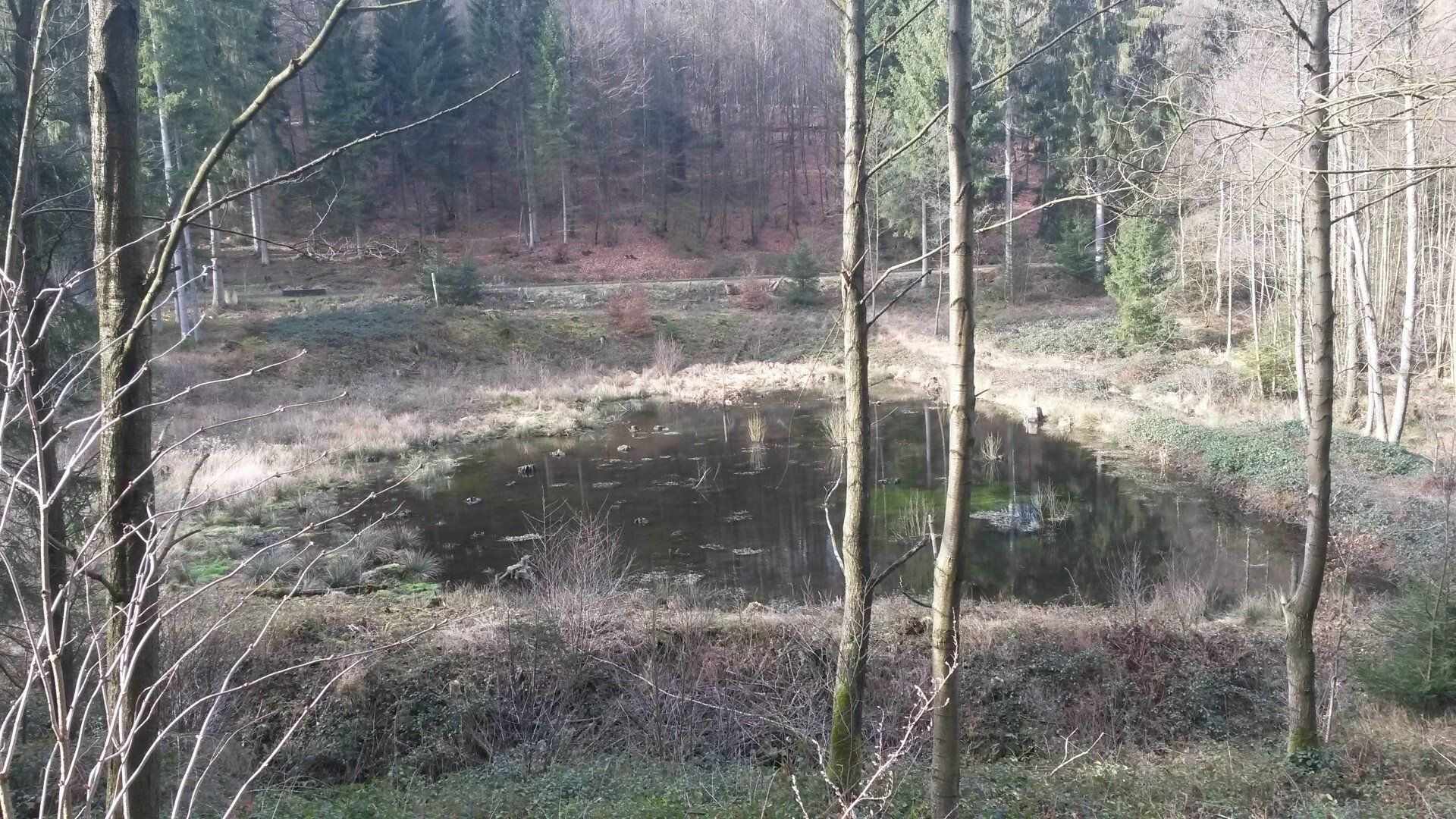
Feuchtbiotop im Mühlbachtal
You can also read this at the wetland biotope:
In front of you lies the uppermost of the seven former monastery ponds, which was possibly created in the middle of the 18th century as an additional water reservoir (note: the Rumbeck Hammer went into operation in 1750). The water retention system was destroyed after 1827 by the Prussian forestry administration in order to gain additional space for wood production. The dams were pierced for this purpose.
The recent heavy rain events have eroded the main dam and the meandering effect of the stream on the side dam, thereby severely damaging the substance of the archaeological monument. With the support and guidance of the HSK's Lower Landscape Authority, the "Village and Monastery of Rumbeck" association has secured and repaired the damaged dam sections. The natural inflow from the western slope, which has always been active, consists of several rivulets that flow out of the "clay path" (on which you are standing).
Originally, the slope seepage water from the mountain springs was collected in channels and fed to the pond via the main collecting ditch (behind you). To do this, the path, which was still very wet 250 - 300 years ago, was crossed under with DRAINS and drained at the same time. The DRAINS are small channels in the clay layer, which were made with hand-laid stone slabs and kept a hollow space open. When the previously seeping inflows were opened up by the heavy rain, the outlet of one of these DRAINS on the valley side was discovered by chance.
The collection system on the mountain side is barely functional anymore because the ditches are covered with humus. The spring water that still seeps down is apparently now pressing into the humus layer that lies beneath the path and was buried around 150 years ago. This layer initially absorbs the water like a sponge and transports it along the path. It then comes out again at the old trenches and flows into the pond.
Before you now lies a contemporary wetland biotope that has been optimized with manageable effort and will enrich the fauna of the Mühlbach Valley in the future.
In front of you lies the uppermost of the seven former monastery ponds, which was possibly created in the middle of the 18th century as an additional water reservoir (note: the Rumbeck Hammer went into operation in 1750). The water retention system was destroyed after 1827 by the Prussian forestry administration in order to gain additional space for wood production. The dams were pierced for this purpose.
The recent heavy rain events have eroded the main dam and the meandering effect of the stream on the side dam, thereby severely damaging the substance of the archaeological monument. With the support and guidance of the HSK's Lower Landscape Authority, the "Village and Monastery of Rumbeck" association has secured and repaired the damaged dam sections. The natural inflow from the western slope, which has always been active, consists of several rivulets that flow out of the "clay path" (on which you are standing).
The Lehmweg was a connecting path from Rumbeck to Hellefeld (as late as 1803). The wetness here posed a problem for traffic, which people thought could be solved with a log dam (some of the logs are still there). The traffic problems caused by inadequate paving later led to the relocation of the connection (before 1827 it was diagonally uphill from the forester's house).
The collection system on the mountain side is barely functional anymore because the ditches are covered with humus. The spring water that still seeps down is apparently now pressing into the humus layer that lies beneath the path and was buried around 150 years ago. This layer initially absorbs the water like a sponge and transports it along the path. It then comes out again at the old trenches and flows into the pond.
Before you now lies a contemporary wetland biotope that has been optimized with manageable effort and will enrich the fauna of the Mühlbach Valley in the future.
Location of the wetland


Photo: Steffi Jürgens


